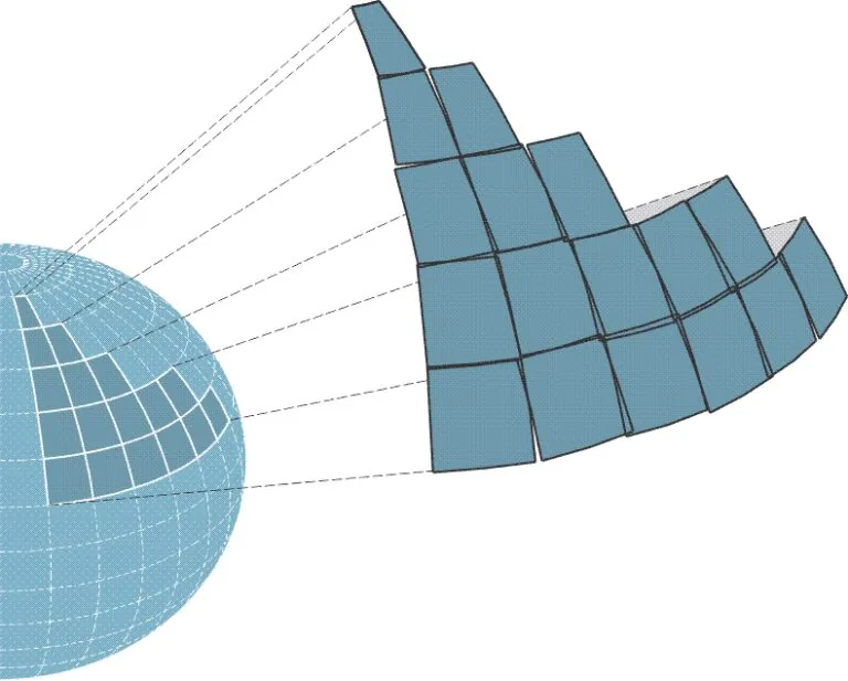
Why Projection Matters
The Earth is a three-dimensional object, roughly spherical in shape. In survey work, however, it is far more convenient to treat the surface as two dimensions — Northing and Easting. To accurately place real-world locations on that flat surface, a coordinate projection is necessary. Without one, the positions reported by GPS would be distorted and inconsistent.
This technique has been used for centuries to draw paper maps. Today it is primarily a mathematical process performed by computers — but even in the digital age, projection cannot be done without introducing some distortion. Choosing the right projection for the job keeps that distortion small.

How Coordinate Projection Works
A GPS device receives signals from a network of satellites orbiting the Earth. Each signal carries the satellite’s position and the time the signal was sent. By measuring the distance to several satellites at once, the receiver determines its own position in three dimensions: latitude, longitude and altitude.
To display that position on a map, the system must project those coordinates onto a flat surface. Many systems use WGS 84 (World Geodetic System 1984) as the global reference frame, giving GPS coordinates a consistent, reliable basis worldwide before they are projected into a local grid.
Types of Projections
There are several families of coordinate projection, each with its own strengths and ideal use cases:
- Mercator: Preserves angles, so compass bearings appear as straight lines — ideal for nautical navigation.
- Transverse Mercator: Minimizes distortion over a narrow band, making it well suited to mapping small areas.
- Lambert Conformal Conic: Balances shape and distance distortion across mid-latitude regions — common in aviation and large-scale mapping.
- Universal Transverse Mercator (UTM): Divides the world into a series of narrow zones for high local accuracy — widely used in GPS for both civilian and military work.
See It In Action
Pick a country below to watch how different projections reshape the same landmass. Notice how a projection that looks right in one part of the world stretches or skews another.
Choosing the Right Projection
Different projections suit different jobs. One that works well for global navigation may be a poor choice for local, detailed mapping. Understanding the strengths and limits of each type is essential for keeping a survey both accurate and usable.
Rule of thumb
For most users, the single most important thing is to pick a coordinate transformation whose zone overlaps the region you are working in. Distortion grows the farther you stray from a projection’s central meridian.
In Summary
Coordinate projection is fundamental to how GPS works, turning spherical positions into a flat, measurable framework. By converting 3D coordinates into 2D Northing and Easting, mapping systems deliver the precise, repeatable locations that everything from everyday navigation to advanced geospatial analysis depends on.