Global Navigation Satellite System
A showcase of our GNSS capabilities.
Our GNSS Expert Partners
Break New Ground
Our long-term partnership with Carlson Software brings with it over 40 years of professional GNSS experience.
We strongly recommend Carlson for all of your GNSS needs as they are deeply committed to their customers and partners.
Whether you use their best-selling GNSS systems combined with their award winning SurvCE or choose to go with a third party, we can provide you with high end tools to integrate positioning into your product or service.
Learn more
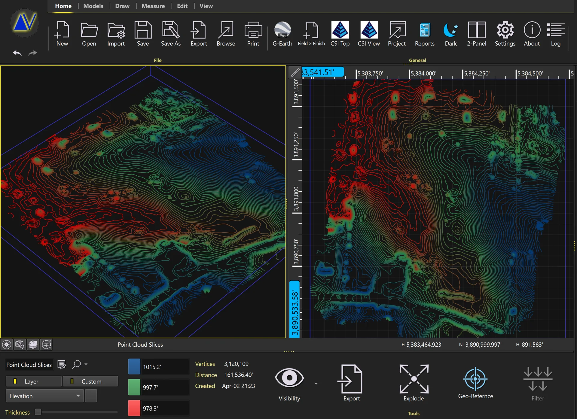
Map GNSS with Ease
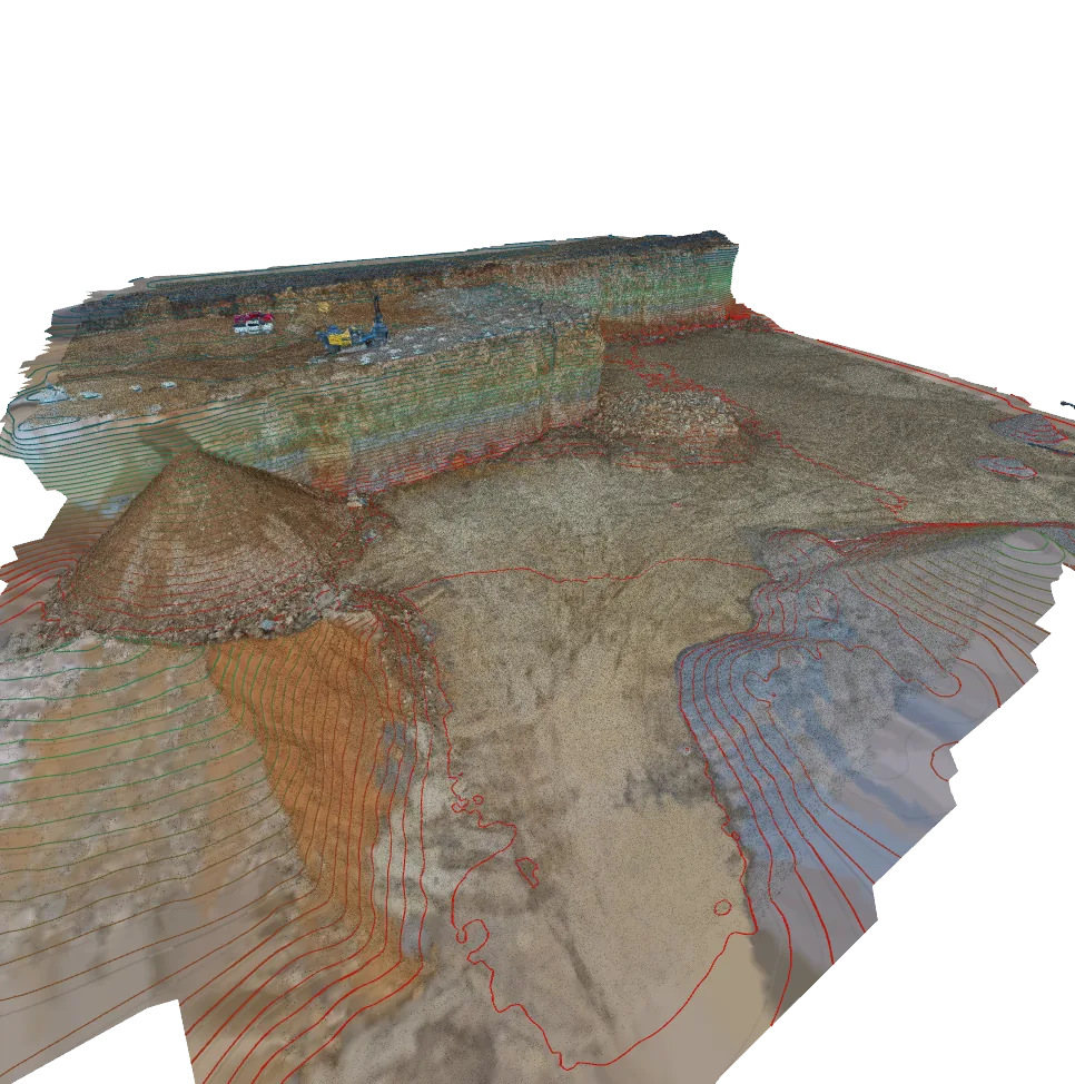
A projected coordinate system is a widely used spatial reference framework in the field of geospatial sciences. It employs Cartesian coordinates (x, y) on a two-dimensional plane that is generated through a specified map projection technique. This system’s advantage is its ability to portray a two-dimensional representation of spatial data with high precision and accuracy.
Furthermore, this system offers an efficient representation of spatial data that can be effectively shared between mapping systems, spatial databases, and geoinformation systems. At NDEVR we have support for hundreds of projections and our expert team can assist in navigating through the complexities of geo-spatial locating.
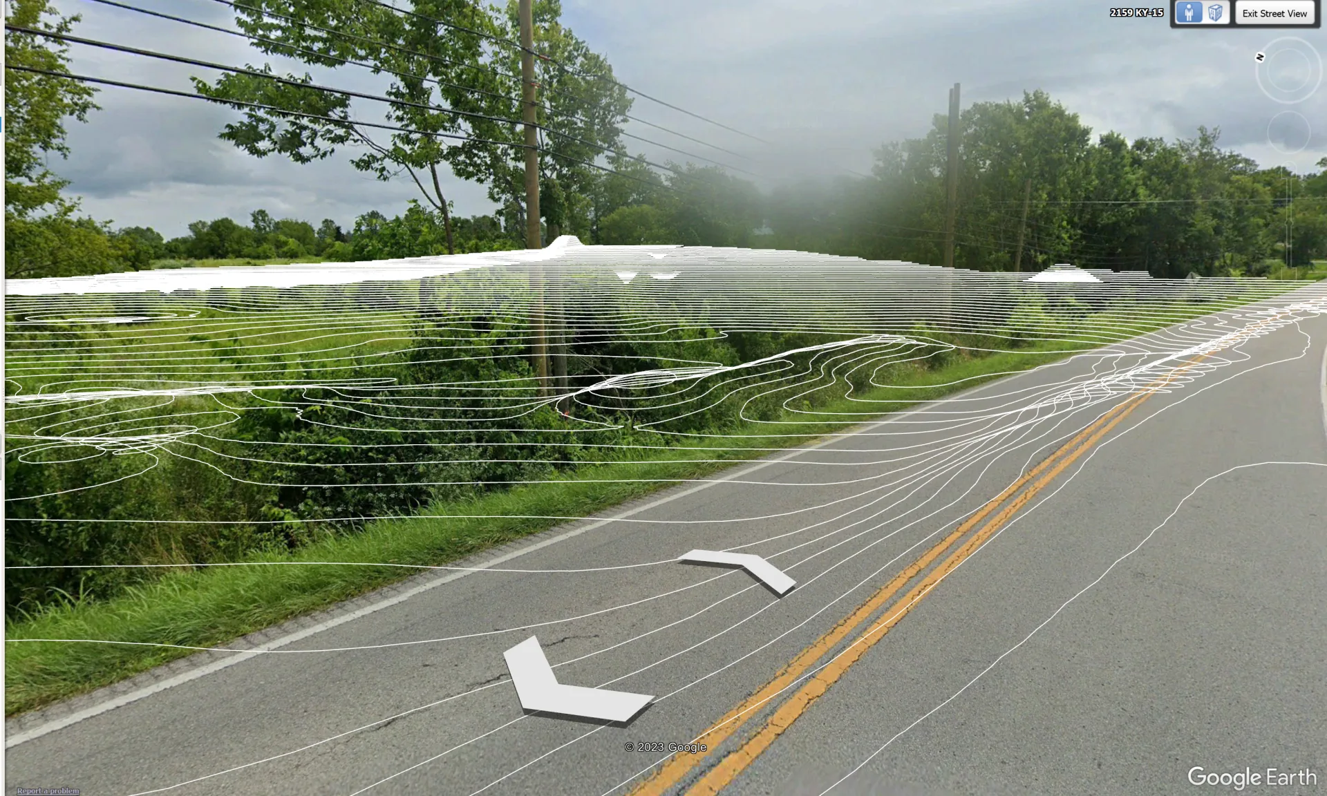
Learn moreGoogle Earth
A photo using Google Earth. There was no description given, but this is what a sample paragraph would look like.
Learn more