By Platform: Where the Sensor Rides
The same ranging physics behaves very differently depending on what carries the scanner and how far it sits from the target.
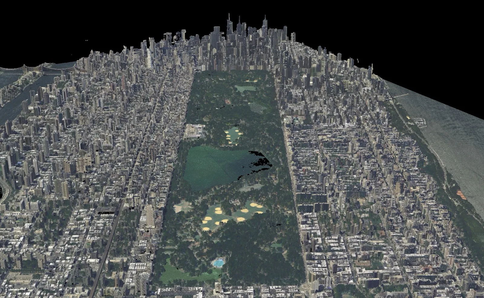
Airborne LiDAR (ALS)
Mounted in a crewed aircraft or large UAV and flown over the landscape. Airborne systems cover enormous areas in a single mission and, thanks to multiple returns, are the workhorse for terrain and forestry mapping. Accuracy depends heavily on the integrated GNSS and IMU that georeference every pulse from a fast-moving platform.
Mobile & UAV LiDAR (MLS)
A scanner bolted to a car, truck, train, or drone, mapping continuously as the platform moves. Mobile mapping is ideal for roads, rail corridors, and utility lines — capturing a road and everything along it at driving speed. Drone LiDAR brings airborne-style coverage to small sites at far lower cost.
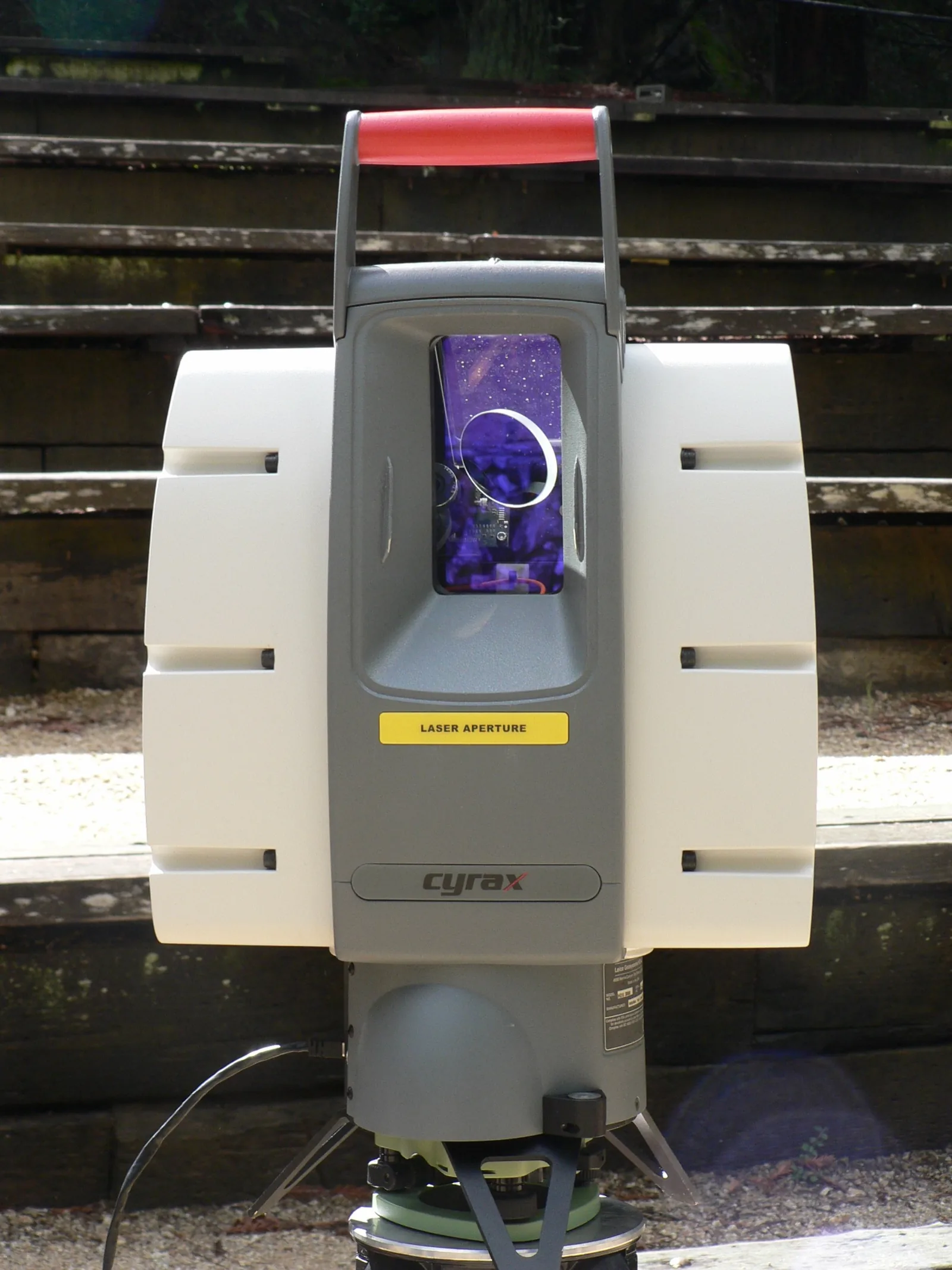
Terrestrial LiDAR (TLS)
A high-precision scanner on a survey tripod, capturing a dense 360° scan from a fixed station. Multiple stations are then registered together into one cloud. TLS delivers the highest point density and accuracy of any platform and is the standard for as-built surveys, building documentation, and forensic capture.
Handheld & SLAM LiDAR
Walk-and-scan systems that build a cloud while you move through a space, using SLAM (Simultaneous Localization and Mapping) to track their own position without GNSS. They trade some accuracy for speed and access — perfect for indoor spaces, tunnels, and cluttered sites where setting up a tripod for every scan is impractical.
Topographic vs Bathymetric
The biggest split by what a LiDAR measures comes down to wavelength.
Topographic
- Near-infrared laser (~905 / 1550 nm)
- Maps land, vegetation, structures
- Water reads as a void
- The vast majority of LiDAR
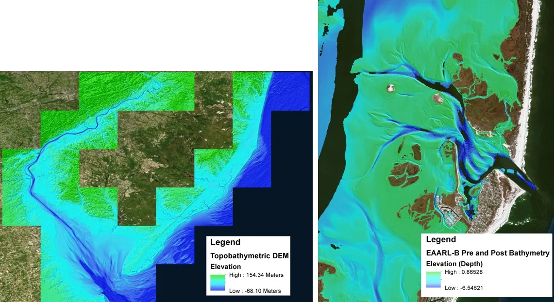
Bathymetric
- Green laser (~532 nm)
- Penetrates clear water
- Maps riverbeds, coasts, shallows
- Limited by water clarity
Topobathymetric
- Both lasers in one system
- Seamless land-to-seabed model
- Coastal & flood mapping
- Single continuous surface
Mechanical vs Solid-State
How the beam is swept across the scene defines a sensor’s reliability, field of view, and cost — the axis that matters most for autonomy and high-volume manufacturing.
- Mechanical (spinning) — a rotating assembly or oscillating mirror physically aims the laser, giving a wide field of view and a mature, well-understood scan pattern. The moving parts add cost and a wear point.
- MEMS — a tiny micro-electromechanical mirror steers the beam with no large moving assembly: smaller, cheaper, more rugged, but usually a narrower field of view.
- Flash — illuminates the whole scene with one wide pulse and reads it on a detector array, like a 3D camera. No scanning at all, so it freezes a frame instantly — at the cost of range.
- Optical phased array (OPA) — steers the beam purely electronically with no moving parts at all. The most solid-state of all, and an active area of development.
Single-Return, Multi-Return & Photon-Counting
Sensors also differ in how they interpret the echo:
- Single-return records one distance per pulse — common in simple or automotive sensors.
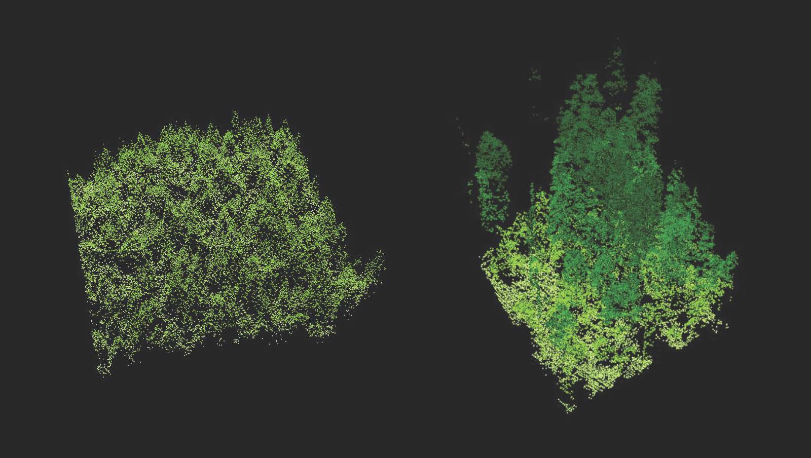
- Multi-return records several echoes per pulse (first through last). This is what lets airborne LiDAR see both canopy and bare earth.
- Full-waveform digitizes the entire returning signal, preserving the most information for advanced analysis.
- Single-photon & Geiger-mode are sensitive enough to register individual photons, enabling very high altitude or long-range collection at high point rates.
These categories stack
A real sensor sits on every axis at once — e.g. a drone-mounted, topographic, MEMS, multi-return LiDAR. When comparing systems, decide which axis your project actually constrains (range? water? cost? moving parts?) and let that drive the choice.
Choosing the Right One
Work down from the job to the sensor: What is the range to the target? Do you need to map underwater? Is the platform moving, and do you have GNSS? How much detail (point density) does the deliverable require, and what is the budget? Those four answers usually narrow the field to a handful of sensors.
For specific hardware across these categories — from budget depth cameras to survey-grade and underground scanners — see our guide to choosing a LiDAR system. If you are still weighing LiDAR against camera-based capture, read LiDAR vs Photogrammetry.