True North
True north is the direction along the Earth’s surface that points toward the geographic North Pole — the fixed point where Earth’s axis of rotation meets its surface. This point is constant and does not change over time. True north is the ultimate reference for global navigation and is used in astronomical and geodetic calculations. Maps usually mark it with a star symbol or a line pointing to the top of the sheet, aligned with the Earth’s meridians.
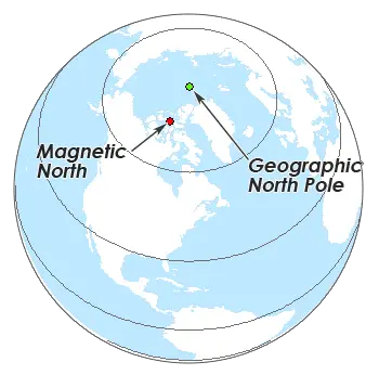
Magnetic North
Magnetic north is the direction a compass needle points, following Earth’s magnetic field. Unlike true north, it is not fixed: it shifts over time as the magnetic field changes, a phenomenon called magnetic drift. Magnetic north sits near Canada’s Arctic and moves gradually. The angle between magnetic and true north at a given location is the magnetic declination — and it must be accounted for whenever you navigate by compass, because it varies with where you stand on the globe.
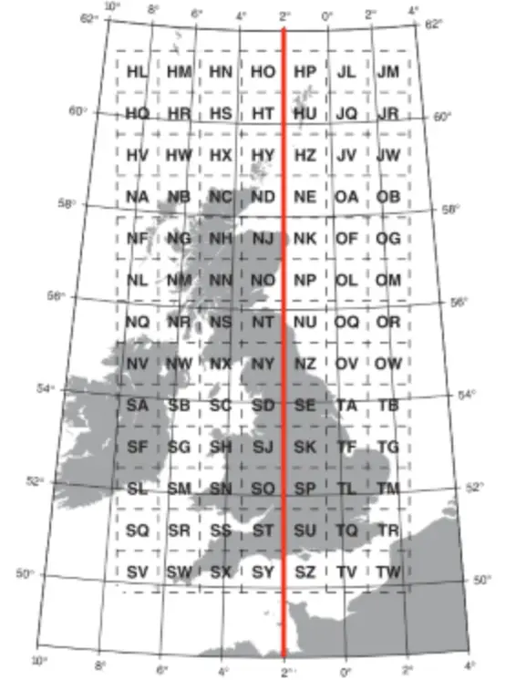
Grid North
Grid north is the direction of the vertical grid lines on a map’s coordinate system, such as Universal Transverse Mercator (UTM) or the Military Grid Reference System (MGRS). It aligns with the map’s grid rather than with true or magnetic north. Because projecting a curved Earth onto a flat map introduces distortion, grid north drifts slightly from true north — a discrepancy called grid convergence that grows the farther you move from the projection’s central meridian.
Key Differences
Variability
- True north is fixed.
- Magnetic north shifts over time and varies by location.
- Grid north stays constant within a projection but differs from true north due to distortion.
Reference point
- True north aligns with the geographic North Pole.
- Magnetic north aligns with Earth’s magnetic field.
- Grid north aligns with a map’s coordinate grid.
Application
- True north for global navigation and astronomical work.
- Magnetic north for compass navigation.
- Grid north for map reading and precise grid references.
Adjusting Between Them
When you navigate, the relationships among the three references are what matter. The angular differences — magnetic declination (true vs. magnetic) and grid magnetic angle (grid vs. magnetic) — must be calculated and corrected for accuracy. Using a compass with a topographic map, for example, you adjust for magnetic declination to translate a compass reading into true or grid north.
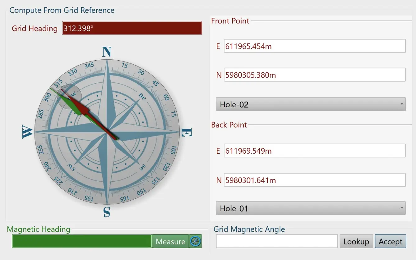
The NDEVR Engine supports Grid Magnetic Angle adjustment directly. For magnetic sensors this is done on the Calculation page: enter a reference grid angle, measure the magnetic angle, and the difference is applied as the grid magnetic angle offset. From then on, magnetic readings are automatically corrected to the grid-magnetic heading.