Six enormous tires. One increasingly optimistic position.
Start with a known location. Measure how far the wheels turn and which way you steer. Add up those movements and you have an estimate of where the vehicle went. That is a simple form of dead reckoning: carrying a position forward from earlier knowledge and measured motion.
Now take the APOCALYPSE HELLFIRE 6×6 into the rainforest. The wheels spin in mud. Fast turns produce understeer and sideways slip. Too much speed in mud sends Rex into a spinout. Sharp steering leaves the truck sliding along its old momentum. In a winding waterway, the HELLFIRE floats with zero traction: the current carries it to the other bank while the wheels report something else entirely. The actual path and the calculated path begin to separate.
In the game, terrain sets the available grip. Speed, throttle, and steering determine how much of that grip you demand. Gentle mode reduces acceleration and limits speed. It helps, but it does not turn a muddy riverbank into a calibrated laboratory.
Scattered clearings
Open ground offers better grip, but truck GPS initially works only inside the starting car lot. After rescuing Geraldo, his wreck provides GPS within 550 toy metres wherever standing trees leave clear sky. Press Space to measure; outside that coverage Rex relies on his motion estimate.
Mud & wet undergrowth
Less grip means more wheel spin and sliding. Hard acceleration and fast steering make the mismatch worse.
Winding waterways
Streams and ponds carry the truck across with zero traction. The unmeasured current and freely spinning wheels distort the estimate. Muddy banks can trigger a spinout at speed.
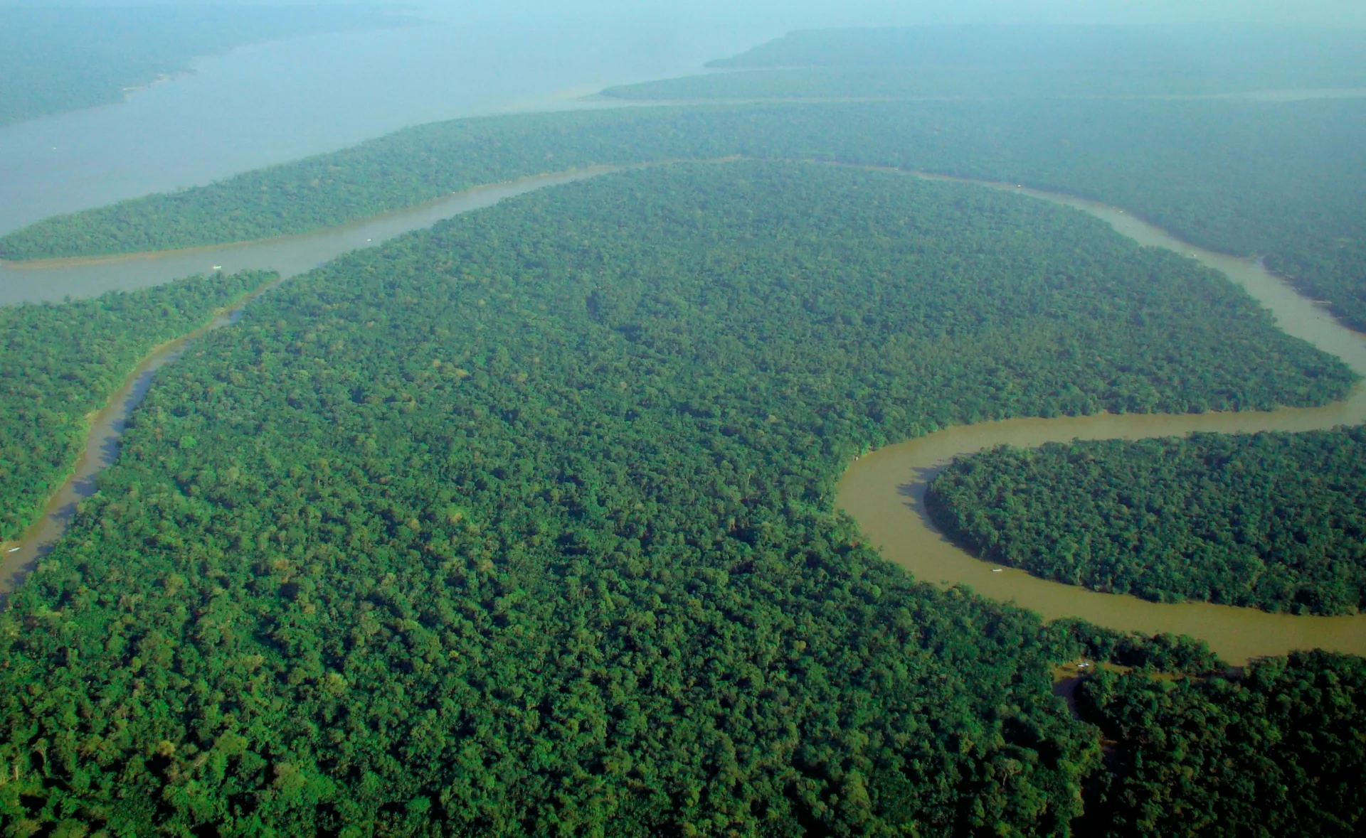

GPS reception and dead-reckoning drift are different problems. Trees can block or weaken the signals reaching a real receiver; real reception is not simply on or off at a forest boundary. Wheel slip affects an estimate based on wheel motion. The game deliberately separates the two mechanisms so you can see them. GPS.gov explains the factors affecting receiver accuracy.
The game does not display a running error estimate. Truck GPS starts at the car lot, and returning there does not automatically correct anything. Rescued helicopter wrecks add 550-metre base-station coverage wherever standing trees leave clear sky. Press Space to remeasure GPS: the game compares that fresh fix with your current dead-reckoned position, reveals the drift at that moment for 15 seconds, and retains the old estimate so you can check again. At the lot, the measured correction is applied when Rex drives back out of the clearing. A base-station measurement applies immediately; beside a relic, Space also records the fresh coordinates. Rex supplies a suitably corny verdict. The displayed value is labeled Last measured drift; it does not track subsequent error. Earlier relic coordinates stay unchanged.
The second GPS fix is useful. It is not a time machine.
You return to the car lot, where GPS becomes valid again. Press Space to take a measurement and compare the position your navigation system predicted with the freshly measured position. The difference is the return mismatch, or closure discrepancy in this example.
That comparison tells you something important about the end of the trip. It does not tell you precisely when the error developed. It also does not overwrite the coordinates you recorded beside the city, temple, or crown.
Imagine the estimate is 20 meters east of reality when you find the crown. Later, a different error shifts the estimate 20 meters west. The final check can look perfect while the crown’s recorded coordinates remain 20 meters wrong. Conversely, a large error introduced after recording the crown could make the return check look poor even though that earlier mark was good.
A small final mismatch is encouraging evidence, not a guaranteed bound on the whole route. A large mismatch is a reason to investigate, not a precise diagnosis of every earlier observation. The game reveals the actual route only after Geraldo completes the search, allowing you to compare what the navigators knew with what really happened.
Geraldo knows where he is. Does he know where the crown is?
Geraldo’s helicopter has perfect GPS in this fictional mission. He can fly accurately to the coordinates you give him. If you recorded the wrong coordinates, he will arrive accurately at the wrong place.
Use Next waypoint to choose a recorded relic. The gold arrow points to that mark, not to the real object. If the winch brings up the wrong thing, turn on the search grid and try a pattern of nearby lifts. Dense fog completely conceals the forest, waterways, parked truck, and ground landmarks while flying. Your blue GPS trail, recorded waypoints, and optional search grid remain visible above the fog. The trail records the helicopter’s route, not an area already searched by the winch. Press Space to lower the hook at individual locations; the helicopter holds a hover during each lift. Flying over a relic never collects or reveals it. There is no hidden arrow pointing to the answer.
The lost city has a large footprint for the hook to hit. The temple needs a closer winch placement. The sacred crown of King Katarakokatokolo III is tiny, so the same waypoint error creates a much harder search. That is why the crown earns 1,000 points, the temple 500, and the city 200. All three must be rediscovered to restore peace to the jungle.
Fuel burns while flying, hovering, and winching. An empty tank grounds the helicopter; refuel at the starting car lot with your notebook and recovered relics preserved. Return to the clear car-lot area and press E to switch vehicles: each remains parked where you left it. You can scout in the truck, try a winch search, and return to Rex for better coordinates. Returning to the car lot for a GPS check is optional. No other clearing restores truck GPS. The winch has a moving needle and a logarithmic load scale so both small catches and enormous loads register. Its built-in readout shows 100 tons for the temple and 2 kg for the crown. The city sends the display to 99999 before it gives up and says HEAVY. Ancient cartoon magic handles the impossible lift. Play the same jungle twice: once as Alfred on his leisurely Sunday drive, and once as Dominic Toretto with somewhere urgent to be. Compare the waypoint errors and Geraldo’s search time.
Each helicopter refill or unboxed replacement queues an oil-well delivery after 20 seconds spent back in the jungle with the truck, even before recovering any relics. Flying, waiting in the car lot, and pausing do not advance that countdown. Queued deliveries remain at least 15 seconds apart and wait if Rex occupies the drop site. After two relics are recovered, regular oil-well deliveries also continue.
Back to the survey: what does an alignment check mean?
A probe with a gyroscope is not a truck with slipping tires. A gyro measures angular rate, and errors in that measurement can accumulate into an orientation error. Bias, noise, temperature effects, and other sensor errors matter. The analogy is about accumulation and incomplete knowledge, not identical physics. See Preserving Heading with an IMU and VectorNav’s explanation of inertial error propagation.
A post-survey alignment check compares the measured orientation with an expected reference. A discrepancy may involve sensor drift, the reference setup, how the instrument was repositioned, or changes during retrieval. The check alone does not separate those causes or locate them in time.
If an indicator turns red after crossing a configured threshold, the direct conclusion is that the comparison exceeded that threshold. It does not automatically establish that every scan point is outside specification, nor that the full difference was sensor drift.
The check matters even when a universal pass/fail number does not
Keep the measured discrepancy and its context. Compare it against the requirements of the actual task and a validated instrument procedure. Avoid turning a convenient display threshold into an unsupported accuracy guarantee.
Can the logs tell us where things went wrong?
Logs may identify events worth investigating: sharp movement, temperature changes, a reset, a long pause, or a changed alignment. Those are clues. Reconstructing the true error at each observation requires enough independent information and a validated model. A detailed log does not automatically provide either.
Is the data acceptable? Should the hole be surveyed again?
The crown and the city need different search precision. Likewise, acceptance depends on the survey objective, geometry, required positional or angular accuracy, reference quality, and the evidence available. A final angular difference is not itself a positional error for every scan point.
- Record the comparison: the discrepancy, reference, timing, and relevant handling events.
- Check the reference and procedure: establish whether the comparison was made under the intended conditions.
- Assess the required result: use the instrument’s validated guidance and the project’s accuracy criteria.
- Resolve insufficient evidence: obtain independent control or repeat the measurement when the available evidence cannot establish that it meets the requirement.
Useful customer guidance can explain what the check measures, what it cannot prove, and what to review next. Recommended tolerances can be valuable when supported by validation for the intended deployment. The problem is an arbitrary universal threshold, not the idea of giving customers guidance.
What is simulated, and what is real?
Game assumptions: all three relics occupy fixed locations so repeat runs are comparable. One world unit represents a toy meter. The car uses simplified motion estimation, wheel slip, and a small heading bias. For playability, the estimate follows most of the truck’s rotation, including spinouts, and retains only 20% of the newly introduced movement error. This assistance uses the simulation’s known movement; it is a game mechanic, not a claim about real navigation sensors. Existing drift and recorded waypoints are not reset by this assistance. The world contains seeded scattered clearings, mud, ponds, and winding streams, with no roads. The truck enters water, loses all traction, and floats across to the far bank with a swaying current. Grip, speed, relic sizes, and detection distances are chosen for playability; they are not measured vehicle or instrument specifications. The truck passes beneath the tree crowns; the foliage is drawn over it. Near-vehicle leaves are partly translucent so the player can still steer. For Geraldo, opaque fog covers the entire ground; terrain, waterways, the parked truck, and relic landmarks are not drawn in the flight view. GPS trail and waypoint overlays remain visible above the fog. A successful winch attempt is required to reveal and recover them.
The car starts from a known position at the car lot. Subsequent exact position and heading references require an explicit Space press there. Other clearings and the eastern edge never restore truck GPS. Outside the car lot, pressing Space records the current estimated position; beside a relic, it saves or replaces that relic’s waypoint. GPS availability alone never resets the position or reveals drift. These are fictional Amazon latitude/longitude values converted from the game’s local meter grid, not real treasure locations. A deliberately requested GPS measurement queues a correction for departure from the clearing; saved marks retain their original coordinates. Truck GPS remains unavailable while floating, including over open water; the same gameplay assistance reduces the resulting drift penalty. The helicopter always receives an exact position. These are deliberately idealized controls: real GPS is not perfect, ordinary single-antenna GPS does not directly measure a stationary vehicle’s heading, and real canopy reception varies. The game performs no smoothing or retrospective correction of saved relic coordinates. Its search grid is a navigation aid, not a confidence region. It uses no real location data.
- GPS.gov — GPS Accuracy: receiver accuracy, obstructions, and reflected signals.
- VectorNav — INS Error Budget: how inertial measurement errors propagate into navigation errors.
- VectorNav — GNSS-Aided Inertial Navigation: combining external position information with inertial estimates.
Failed winch attempts produce playful jungle catches: a 5 kg monkey, 55 kg aardvark, 3 kg snake, 1.2 kg piranha, or assorted debris. These are illustrative game weights, not species specifications. The vacationing aardvark is deliberately out of place in this fictional Amazon. Animals are lowered safely again. Treasure loads and the helicopter’s lifting ability are equally cartoonish.
The intro music and sound effects are original procedural Web Audio synthesis, played locally after sound is enabled. The pixel-art opening was generated for NDEVR with OpenAI ImageGen. Its source illustration is available here. The NDEVR logo is the existing brand mark; the playable terrain, vehicles, relics, route diagram, and game model are original NDEVR work. The photograph is credited separately above. Katarakoka, its sacred crown, and Geraldo’s mission are fictional.
